
পঞ্চগড় সদর উপজেলা - Panchagarh Sadar Upazila
পঞ্চগড় সদর উপজেলা পঞ্চগড় জেলার প্রধান শহর ও প্রশাসনিক কেন্দ্র। এটি জেলার প্রশাসনিক ও বাণিজ্যিক কার্যক্রমের অন্যতম প্রধান কেন্দ্র হিসেবে গুরুত্বপূর্ণ ভূমিকা পালন করে। এখানে জেলা প্রশাসনের প্রধান কার্যালয়সহ বিভিন্ন সরকারি ও বেসরকারি প্রতিষ্ঠান অবস্থিত।
শহর ও গ্রামের সমন্বয়ে গড়ে ওঠা এই উপজেলায় একদিকে রয়েছে আধুনিক সুযোগ-সুবিধা, অন্যদিকে গ্রামীণ জীবনের স্বাভাবিক সৌন্দর্যও বিদ্যমান। উন্নত যোগাযোগ ব্যবস্থা, মানসম্মত শিক্ষা প্রতিষ্ঠান এবং ক্রমবর্ধমান ব্যবসা-বাণিজ্যের কারণে পঞ্চগড় সদর উপজেলার গুরুত্ব দিন দিন বৃদ্ধি পাচ্ছে।
নামকরণঃ পঞ্চগড় সদর উপজেলার নামকরণ পঞ্চগড় জেলার নামকরণের ঐতিহ্য বহন করে। জনশ্রুতি আছে, গৌড় রাজ্যকে এক সময় বলা হতো পঞ্চ গৌড়। আর পঞ্চ গৌড় হতেই প্রাকৃত ভাষার বৈশিষ্ট্য অনুযায়ী পঞ্চগড়ের নামকরণ। অবশ্য বহুল প্রচলিত মত হলো – মীরগড়, ভিতরগড়, হোসেনগড়, দেবনগড় ও রাজনগড় – এ পাঁচ গড় অর্থাৎ মাটির তৈরী দূর্গ-এর নামানুসারেই পঞ্চগড় নামটির উৎপত্তি।
ভৌগোলিক অবস্থান ও আয়তনঃ পঞ্চগড় সদর উপজেলা ২৬°১৭´ থেকে ২৬°২৯´ উত্তর অক্ষাংশ এবং ৮৮°৩১´ থেকে ৮৮°৪৬´ পূর্ব দ্রাঘিমাংশ স্থানাঙ্কে অবস্থিত। পঞ্চগড় সদর উপজেলার উত্তরে তেঁতুলিয়া উপজেলা ও পশ্চিমবঙ্গের জলপাইগুড়ি, দক্ষিণে বোদা উপজেলা, পূর্বে ভারতের জলপাইগুড়ি জেলা এবং পশ্চিমে আটোয়ারী উপজেলা ও পশ্চিমবঙ্গ অবস্থিত। পঞ্চগড় সদর উপজেলার আয়তন ৩৪৭.০৯ বর্গ কিমি বা ১৩৪ বর্গ মাইল।
প্রশাসনিক এলাকাঃ ভৌগোলিকভাবে পঞ্চগড়ের মধ্যভাগে অবস্থিত পঞ্চগড় সদর উপজেলা এখানকার প্রধান প্রশাসনিক অঞ্চল। পঞ্চগড় সদর উপজেলা ১ টি পৌরসভা, ১০ টি ইউনিয়ন, ৭৫ টি মহল্লা/মৌজা এবং ১৯৫ টি গ্রাম নিয়ে গঠিত। এছাড়া জেলার প্রশাসনিক কেন্দ্র পঞ্চগড় সদর উপজেলায় রয়েছে সরকারি সকল প্রধান স্থাপনা, সদর থানা, সদর হাসপাতাল, প্রধান আদালত, ট্রেজারী অফিস এবং জেলা পরিষদ অফিস। পঞ্চগড় সদর উপজেলার ১০ টি ইউনিয়নের নামঃ
(১) অমরখানা ইউনিয়ন
(২) কামাত কাজলদীঘি ইউনিয়ন
(৩) গড়িনাবাড়ি ইউনিয়ন
(৪) চাকলারহাট ইউনিয়ন
(৫) ধাক্কামারা ইউনিয়ন
(৬) পঞ্চগড় সদর ইউনিয়ন
(৭) মাগুড়া ইউনিয়ন
(৮) সাতমারা ইউনিয়ন
(৯) হাড়িভাসা ইউনিয়ন
(১০) হাফিজাবাদ ইউনিয়ন
জনসংখ্যাঃ ২০১১ এর আদমশুমারি তথ্য অনুসারে পঞ্চগড় সদর উপজেলার জনসংখ্যা ছিল মোট ২৭১৭০৭ জন। পুরুষ ১৩৬৮৫০ জন এবং মহিলা ১৩৪৮৫৭ জন। মুসলিম ২৫৪৬১২, হিন্দু ১৬৮৫৫, বৌদ্ধ ৪, খ্রিস্টান ১৬৩ এবং অন্যান্য ৭৩।
উল্লেখযোগ্য শিক্ষা প্রতিষ্ঠানঃ
(ক) বিষ্ণু প্রসাদ উচ্চ বিদ্যালয় (১৯৪৪)
(খ) মকবুলার রহমান সরকারি কলেজ
(গ) মীরগড় সরকারি প্রাথমিক বিদ্যালয় (১৯১৮)
(ঘ) ময়নাগুড়ি প্রাথমিক বিদ্যালয় (১৯২৮)
(ঙ) পঞ্চগড় সরকারি টেকনিক্যাল স্কুল ও কলেজ
(চ) পঞ্চগড় সরকারি মহিলা কলেজ
(ছ) পঞ্চগড় সরকারি বালিকা উচ্চ বিদ্যালয়
(জ) পঞ্চগড় যুব উন্নয়ন অধিদপ্তর
ইতিহাসঃ বৃটিশ শাসনামলে পঞ্চগড় সদর জলপাইগুড়ি জেলার অমত্মর্ভূক্ত হয় এবং ১৯১১-১৯১২ খ্রিঃ একটি পূর্ণাঙ্গ থানায় উন্নীত হয়। ১৯৪৭ সালে পাক-ভারত বিভক্তির সময় বর্তমান পঞ্চগড় জেলার ৪ টি থানা জলপাইগুড়ি থেকে বিচ্ছিন্ন করে দিনাজপুর জেলার অমত্মর্ভূক্ত করা হয়। এরই ধারাবাহিকতায় ১৯৪৯ সালে এখানে স্থাপিত হয় মুন্সেফ, ম্যাজিষ্ট্রেট কোর্ট, পুলিশ ইন্সপেক্টর ও সার্কেল অফিস। অতঃপর ঠাকুরগাঁও মহকুমার আটোয়ারী থানাকে বোদা, দেবীগঞ্জ,পঞ্চগড় ও তেতুলিয়ার সাথে যুক্ত করে পঞ্চগড় মহকুমা গঠিত হয় ১৯৮০ সালের ১ জানুয়ারী। এরপর ১ জুন ১৯৮৩ সালে এটি মান উন্নীত থানায় রূপামত্মরিত হয়। পরবর্তীতে মান উন্নীত থানাকে উপজেলায় রূপামত্মর করা হলে উপজেলা হিসেবে এর কার্যক্রম শুরু হয় ১৯৮৪ সালের ১ ফেব্রুয়ারী।
১৯৪৯-৫০ সালে ভারতের জলপাইগুড়ি শহরে হিন্দু-মুসলিম দাঙ্গা সংঘটিত হলে বিপুলসংখ্যক মুসলমান পালিয়ে এসে পঞ্চগড়ের শহর ও গ্রাম এলাকায় বসতি গড়ে তোলে। সন্ন্যাসী ও ফকির বিদ্রোহ (১৭৬২-১৮০০), তেভাগা-আন্দোলন (১৯৩৮-৩৯, ৪৬-৪৭), ভাষা-আন্দোলন, পঞ্চগড়ে মহকুমা প্রতিষ্ঠার আন্দোলন (১৯৪৯-৮০), কৃষক-আন্দোলন (১৯৫৮-৬৮), সীমান্তবর্তী ইপিআরদের অত্যাচারের বিরুদ্ধে প্রতিবাদ ও ঊনসত্তরের গণঅভ্যূত্থান প্রভৃতি আন্দোলন ও বিদ্রোহে উপজেলার জনগণ সক্রিয়ভাবে অংশগ্রহণ করেছে।
১৯৭১-এর মুক্তিযুদ্ধে পঞ্চগড় সদরঃ ১৯৭১ সালের ২৫ মার্চের পর পাকবাহিনী সারাদেশে আক্রমণ শুরু করলেও ১৬ এপ্রিল পর্যন্ত পঞ্চগড় মুক্ত থাকে। ১৯৭১ সালের এপ্রিল মাসের মাঝামাঝি সময়ে মুক্তিসেনারা সৈয়দপুর, দশমাইল এলাকায় পাকবাহিনীর তীব্র আক্রমনের সম্মুখীন হয়। ১৪ এপ্রিল মুক্তিযোদ্ধারা কিছুটা পিছু হটে পঞ্চগড় সদরের সিএন্ডবি মোড়ে অবস্থান নেয়। পাকবাহিনী সড়ক পথে ভারি অস্ত্র ও গোলাবারুদ নিয়ে পঞ্চগড়ের দিকে অগ্রসর হয়ে ১৭ এপ্রিল সকাল সাড়ে ৯টার দিকে পঞ্চগড় দখল করে নিলে মুক্তিসেনারা অবস্থান পরিবর্তন করে তেঁতুলিয়া উপজেলার মাগুরমারি এলাকায় চলে আসে। ১৭ এপ্রিল রাতেই মুক্তিসেনারা চাওয়াই নদীর ব্রীজ ডিনামাইট চার্জ করে উড়িয়ে দেয়। ব্রীজ উড়িয়ে দেয়ায় পাকসেনারা নদীর এপারে অমরখানা নামক স্থানে অবস্থান নেয়। নদীর এপারে পাকবাহিনী আর ওপারে মুক্তিবাহিনী। এই পরিস্থিতিতে জুলাই মাস পর্যন্ত প্রতিদিনই চলতে থাকে খন্ডযুদ্ধ ও গুলি বিনিময়। চাওয়াই নদীতে আর কোনো ব্রিজ না থাকায় পাকসেনারা তেঁতুলিয়ার দিকে আর অগ্রসর হতে পারেনি। ১৯৭১ সালের ১৯ এপ্রিল থেকে ৩০ এপ্রিল পাকবাহিনী উপজেলা শহরে এবং মীরগড়ে অর্ধশতাধিক নিরীহ লোককে হত্যা করে। জুলাই মাসে অমরখানায় পাকবাহিনী ১৬ জনকে হত্যা করে। মুক্তিযোদ্ধারা পঞ্চগড়ের মীরগড়, অমরখানা এবং এই উপজেলার উত্তরপূর্ব অংশের বেশ কয়েকটি স্থানে অপারেশন পরিচালনা করে। ১৯৭১ সালের ২৯ নভেম্বর বীর মুক্তিসেনারা ভারতীয় মিত্র বাহিনীর সহায়তায় পঞ্চগড়কে পাকসেনাদের কবল থেকে দখলমুক্ত করতে সমর্থ হয়। …পঞ্চগড় সদর উপজেলার মুক্তিযোদ্ধাদের তালিকা | পঞ্চগড়ের শহীদ মুক্তিযোদ্ধাদের তালিকা
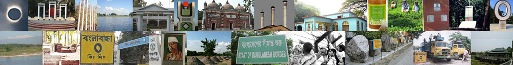
পঞ্চগড় সদর উপজেলার দর্শনীয় স্থানঃ
(ক) মহারাজদীঘি
(খ) ভিতরগড় দুর্গ নগরী
(গ) রক্স মিউজিয়াম
(ঘ) হিমালয় বিনোদন পার্ক
(ঙ) পঞ্চগড় ফরেস্ট
(চ) শেরে বাংলা পার্ক
(ছ) পঞ্চগড় সিটি পার্ক
(জ) করতোয়া সেতু
(ঝ) দৃষ্টিনন্দন পঞ্চগড়ের সদর উপজেলা পরিষদ
(ঞ) উত্তর বাংলা পার্ক
(ট) ভাঙ্গা বন পার্ক
(ঠ) মিরগড় কাঠের ব্রিজ
(ড) পঞ্চগড় রেলওয়ে স্টেশন
(ঢ) মুক্তাঞ্চল পার্ক
(ণ) পঞ্চগড় জেলার প্রথম চা বাগান
(ত) আশ্রয়ণ সেতু
…পঞ্চগড়ের অন্যান্য দর্শনীয় স্থানসমূহ
নদীঃ পঞ্চগড় সদর উপজেলায় ৬ টি নদী রয়েছে। দেওয়ানহাট, চাকলাহাট, সোনারবান এবং বেংহারী পঞ্চগড় সদরের উল্লেখযোগ্য বিল।
(১) করতোয়া নদী
(২) টাঙ্গন নদী
(৩) চাওয়াই নদী
(৪) চাউলি নদী
(৫) কুড়ুম নদী
(৬) তালমা নদী
…পঞ্চগড় জেলার নদ-নদী
পঞ্চগড় সদর উপজেলার প্রখ্যাত ব্যক্তিত্বঃ তেঁতুলিয়ার প্রখ্যাত ব্যক্তিদের মধ্যে উল্লেখযোগ্য কয়েকজন হলেনঃ
(ক) মজহারুল হক প্রধান
(খ) নাজমুল হক প্রধান
(গ) নুরুল ইসলাম নুরু
(ঘ) আনোয়ার সাদাত সম্রাট
(ঙ) দেলোয়ার হোসেন
(চ) ভাষা সৈনিক আব্দুল কাদির
(জ) হাশেম আখতার মোঃ করিমদাদ
(ঝ) শহীদ মুক্তিযোদ্ধা হারুন অর রশীদ রবি
(ঞ) জল বাংলা কবি আবুল কালাম আজাদ
…পঞ্চগড়ের অন্যান্য উল্লেখযোগ্য ব্যক্তিত্ব
অর্থনীতি ও শিল্প কারখানাঃ পঞ্চগড় সুগার মিলস, রাইসমিল, হাসকিং মিল, স’মিল, কারেন্ট পিলার ইন্ডাস্ট্রি, এশিয়া ডিস্টিলারীজ (ইন্ডাস্ট্রিয়াল স্পিরিট), হোমিও ল্যাবরেটরি, ওয়েল্ডিং কারখানা পঞ্চগড় সদর উপজেলার প্রধান শিল্প কারখানা।
(ক) পঞ্চগড় সুগার মিলস সমগ্র জেলার বৃহত্তম ভারী শিল্প।
(খ) পঞ্চগড় সদরে গড়ে উঠেছে চা শিল্প কেন্দ্রিক অর্থনৈতিক কার্যক্রম।
(গ) পঞ্চগড় সদর উপজেলার নুড়ি পাথর উত্তোলন এখানকার স্থানীয় স্থানীয় শ্রমিকদের অন্যতম জীবিকা।
(ঘ) জেমকন লিমিটেড
(ঙ) জেমজুট
(চ) পঞ্চগড় সদরের প্রধান কৃষিজাত পণ্য ধান, পাট, গম, আখ, আলু, তিল, তিসি, তরমুজ, বাঁশ, শাকসবজি।
(ছ) প্রধান ফল-ফলাদি আম, কাঁঠাল, পেয়ারা, কলা, ডালিম, আনারস, আতা, তরমুজ, সুপারি।
(জ) প্রাকৃতিক সম্পদ নুড়ি পাথর, সিলিকা বালু।
(ঝ) প্রধান রপ্তানিদ্রব্য অর্গানিক চা, পাথর, তরমুজ, আনারস, কাঁঠাল, পেঁপে, রসুন।
(ঞ) কুটিরশিল্প স্বর্ণশিল্প, লৌহশিল্প, মৃৎশিল্প, তাঁতশিল্প, বাঁশ ও কাঠের কাজ।
…পঞ্চগড়ের শিল্প ও বাণিজ্য
হাটবাজার ও মেলাঃ পঞ্চগড় সদর উপজেলায় রাজনগর হাট, জগদল হাট, ঝলই হাট, হাড়িভাসা হাট, মডেল হাট, ফুটকীবাড়ি হাট, মাগুড়া-দলুয়া হাট, চাকলা হাট, গলেহা হাট, তালমা হাট, মীরগড় হাট, জিয়াবাড়ি হাট, টুনির হাট, দেওয়ান হাট, কাজীর হাট সহ মোট ৩৪ টি হাট-বাজার রয়েছে এবং জেলা পরিষদ চত্তর, পঞ্চগড় সদর ও আমলাহারে অনুষ্ঠিত পঞ্চগড় সদরের উল্লেখযোগ্য মেলা।
যোগাযোগ ব্যবস্থাঃ অবস্থানগত কারণে পঞ্চগড় সদর উপজেলার সড়ক যোগাযোগ ব্যবস্থা বেশ উন্নত। পাকারাস্তা ৬৮ কিমি, আধা-পাকারাস্তা ১ কিমি, কাঁচারাস্তা ৭৩৪ কিমি; রেলপথ ৮ কিমি; নৌপথ ৮৪ কিমি। N5 বা ঢাকা-বাংলাবান্ধা জাতীয় মহাসড়কটি রাজধানী ঢাকার সাথে পঞ্চগড় সদর হয়ে বাংলাবান্ধা স্থলবন্দরকে সংযুক্ত করেছে।পঞ্চগড় সদরে অবস্থিত বীর মুক্তিযোদ্ধা সিরাজুল ইসলাম রেলওয়ে স্টেশন বা পঞ্চগড় স্টেশন উত্তরবঙ্গের সর্বশেষ রেলওয়ে স্টেশন। পঞ্চগড় রেলওয়ে স্টেশন (বী.মু.সি.ই.) থেকে বর্তমানে (২০২৪) ৬ টি ট্রেন চলাচল করে। পঞ্চগড় থেকে ঢাকায় তিনটি আন্তঃনগর ট্রেন দ্রুতযান, পঞ্চগড় এক্সপ্রেস ও একতা এক্সপ্রেস চলাচল করছে। পঞ্চগড়-রাজশাহী রেলপথে চলাচল করছে বাংলাবান্ধা এক্সপ্রেস।
পঞ্চগড় সদর থেকে রাজধানী ঢাকার দূরত্ব ৪১৫ কিমি এবং সৈয়দপুর বিমানবন্দরের দূরত্ব প্রায় ৯০ কিমি। …Travel Tips | Accommodation | Tourist Spots
Last updated: 20 March 2024