
বোদা উপজেলা - Boda Upazila
পঞ্চগড় জেলার বোদা উপজেলা একটি শান্ত, সবুজে ঘেরা ও সম্ভাবনাময় জনপদ। উর্বর কৃষিজমি ও পরিশ্রমী মানুষের কারণে এখানে ধান, ভুট্টা ও বিভিন্ন ফসলের উৎপাদন ব্যাপক। সাম্প্রতিক সময়ে চা চাষের প্রসার এ অঞ্চলের অর্থনীতিতে নতুন গতি এনে দিয়েছে। সহজ-সরল জীবনযাপন, আন্তরিক মানুষ এবং প্রাকৃতিক সৌন্দর্যের কারণে বোদা একটি স্বতন্ত্র আকর্ষণ বহন করে। পঞ্চগড়ের বোদা উপজেলা ইতিহাস ও ঐতিহ্যে সমৃদ্ধ।
নামকরণঃ পঞ্চগড় জেলার বোদা উপজেলার বড়শশী ইউনিয়নের বদেশ্বরী মৌজার বরদেশ্বরী বা বদেশ্বরী মন্দিরটির নামানুসারে বোদা উপজেলার নামকরণ করা হয়েছে বলে জনশ্রুতি আছে। ঐতিহাসিক স্থাপনা বরদেশ্বরী মহাপীঠ অন্যতম পীঠস্থান। করতোয়া নদীর তীর ঘেঁষে নির্মিত বরদেশ্বরী বা বদেশ্বরী মহাপীঠ মন্দিরটি প্রত্নতাত্ত্বিক ঐতিহ্যের নিদর্শন বহন করে।
ভৌগোলিক অবস্থান ও আয়তনঃ বোদা উপজেলা ২৬°০৫´ থেকে ২৬°২৩´ উত্তর অক্ষাংশ এবং ৮৮°২৭´ থেকে ৮৮°৪৬´ পূর্ব দ্রাঘিমাংশ স্থানাঙ্কে অবস্থিত। বোদা উপজেলার উত্তরে পঞ্চগড় সদর উপজেলা, দক্ষিণে ঠাকুরগাঁও সদর উপজেলা ও দেবীগঞ্জ উপজেলা, পূর্বে দেবীগঞ্জ উপজেলা, পশ্চিমে আটোয়ারী উপজেলা ও পঞ্চগড় সদর উপজেলা। বোদা উপজেলার আয়তন ৩৪৯.৪৭ বর্গ কিমি বা ২১৭ বর্গ মাইল।
প্রশাসনিক এলাকাঃ ছিয়াত্তরের মন্বত্ত্বরে বোদার জনসংখ্যা অর্ধেকে নেমে আসলে লোকবলের অভাবে এ অঞ্চলের কৃষিকাজ মারাত্মকভাবে ব্যাহত হয়। এ দূর্যোগে সরকারিভাবে ভুমি রাজস্বের পরিমান বৃদ্ধি করা হলে জমিদার দেবীসিংহ বাড়তি রাজস্ব আদায়ের জন্য কৃষকদের উপর বল প্রয়োগ শুরু করেন। এর প্রতিবাদে কৃষকরা জেলা কালেক্টরের স্মরনাপন্ন হলে তিনি ছিলেন নির্বিকার। এ পরিপ্রেক্ষিতে কৃষকরা ১৭৮৩ খ্রিঃ সংঘবদ্ধ হয়ে বিদ্রোহ ঘোষনা করে। কৃষকদের আক্রমনের ফলে দেবীসিংহের গোমস্তারা পলায়ন করে এবং কয়েকজন কর্মচারী আহত–নিহত হন। কৃষকরা ক্রমান্বয়ে ব্রিটিশ সরকারকে অমান্য করতে আরম্ভ করে। সরকার বিদ্রোহ দমন করতে সেনাবাহিনী মোতায়েন করেন। এতে বহু কৃষক আহত–নিহত হন এবং আন্দোলনের শেষ অবধি কৃষকদের চাপে সরকার দেবীসিংহকে আটক করে এবং ভূমি রাজস্ব হ্রাস করতে বাধ্য হয়। অত্র অঞ্চলে কোন প্রশাসনিক ইউনিট না থাকায় এবং এলাকাটি ঘনঅরণ্য বেষ্টিত হওয়ায় বৃটিশ সরকার সামগ্রিক কৃষক বিদ্রোহ দমনে ব্যর্থ হয় এবং এ এলাকায় বৃট্রিশ সরকারের পূর্ণ নিয়ন্ত্রণ প্রতিষ্ঠার লক্ষ্যে সরকার একটি প্রশাসনিক ইউনিট সৃষ্টি করার প্রয়োজনীয়তা অনুভব করলে ১৭৯৭ সালে বোদা থানার গোড়াপত্তন হয়।
১৭৭০–১৮৬৮ পর্যন্ত বোদা পরগনা রংপুর জেলার অধীনে ছিল। ১৮৬৯ –১৯৪৭ সাল পর্যন্ত বোদা ছিল জলপাইগুড়ি জেলার অধীন। কুচবিহার প্রশাসন, বোদা থানা প্রদত্ত সম্পত্তি রেট ফি হিসেবে বোদা থানাকে দান করে ১লা সেপ্টেম্বর ১৮৮৩ তারিখে একটি আদেশ জারি করেন। আদেশটি ০৯/০১/১৯৮৪ তারিখে কলকাতা প্রথম খন্ডের ১৭৭ নং পৃষ্ঠায় প্রকাশিত হয়। জলপাইগুড়ি জেলার অধীন তিনটি থানা ছিল (১) জলপাইগুড়ি সদর (২)রাজগঞ্জ এবং (৩) বোদা। বোদা ছিল জলপাইগুড়ি জেলার বৃহত্তম থানা। বোদা থানার অধীন দুইটি পুলিশ আউট পোষ্ট ছিল। একটি পঞ্চগড়ের উত্তরে জগদল এবং অপরটি করতোয়া নদীর পূর্ব পাড়ে দেবীগঞ্জ। কালক্রমে দেবীগঞ্জ এবং জগদল পূর্ণাঙ্গ থানায় রুপান্তরিত হয়। জগদল হতে থানাটি পরবর্তীকালে পঞ্চগড় (বর্তমানস্থানে) স্থানান্তর করা হয়। ১৯৪৭ সালে দেশ বিভাগের পর দিনাজপুর জেলা, ঠাকুরগাঁও মহকমুার নিয়ন্ত্রণে আসে। বর্তমানে এ অঞ্চলটি পঞ্চগড় জেলার অধীন।
বর্তমানের বোদা উপজেলা ১০ টি ইউনিয়ন, ১৫১ টি মহল্লা/মৌজা এবং ২১৯ টি গ্রাম নিয়ে গঠিত। বোদা উপজেলার ১০ টি ইউনিয়নের নামঃ
(১) ঝলইশালশিরি ইউনিয়ন
(২) ময়দানদিঘি ইউনিয়ন
(৩) বেংহারি ইউনিয়ন
(৪) কাজলদিঘী কালিয়াগঞ্জ ইউনিয়ন
(৫) বড়শশী ইউনিয়ন
(৬) মাড়েয়া ইউনিয়ন
(৭) চন্দনবাড়ী ইউনিয়ন
(৮) বোদা ইউনিয়ন
(৯) সাকোয়া ইউনিয়ন
(১০) পাঁচপীর ইউনিয়ন
জনসংখ্যাঃ ২০১১ এর আদমশুমারি তথ্য অনুসারে বোদা উপজেলার জনসংখ্যা ছিল মোট ২,৩২,১২৪ জন। পুরুষ ১,১৬,৫৫৫ জন এবং মহিলা ১,১৫,৫৬৯ জন।
উল্লেখযোগ্য শিক্ষা প্রতিষ্ঠানঃ শিক্ষা প্রতিষ্ঠানের মধ্যে উল্লেখযোগ্য হলো ১৮৮৮ খ্রিষ্টাব্দে প্রতিষ্ঠিত বোদা পাইলট উচ্চ বিদ্যালয়। যেটি বর্তমানে সরকারি মডেল স্কুল অ্যান্ড কলেজে রূপান্তরিত হয়েছে। বোদা উপজেলায় একটি সরকারি কলেজ রয়েছে, যা পাথরাজ সরকারি কলেজ নামে পরিচিত। কলেজটিকে ২০১৮ সালে সরকারিকরণ করা হয়। এছাড়া উপজেলাটিতে বোদা পাইলট গার্লস স্কুল এন্ড কলেজ নামক বালিকা বিদ্যালয় এবং বোদা মহিলা মহাবিদ্যালয় নামক একটি সনামধন্য মহিলা কলেজ রয়েছে।
(ক) বোদা পাইলট উচ্চ বিদ্যালয় (১৮৮৮)
(খ) নয়াদিঘি প্রাথমিক বিদ্যালয় (১৮২৮)
(গ) গোয়ালপাড়া প্রাথমিক বিদ্যালয় (১৮৩০)
(ঘ) বোদা আদর্শ প্রাথমিক বিদ্যালয় (১৮৭৩)
(ঙ) ময়নাদিঘি বিএল উচ্চ বিদ্যালয় (১৯২৯)
ইতিহাসঃ বোদা উপজেলা বিভিন্ন ঐতিহাসিক ঘটনার সাক্ষী হয়ে আছে, দেবীসিংহের বিরুদ্ধে কৃষক বিদ্রোহ (অষ্টাদশ শতকের শেষাংশ), সন্ন্যাসী ও বিদ্রোহ (১৭৬৩-১৮০০), সিপাহী বিদ্রোহ (১৮৫৭), তেভাগা আন্দোলন (১৯৩৮-১৯৪৭), কৃষক আন্দোলন (১৯৫৮-৬৮), ১৯৬৯ সালের গণআন্দোলনে এ উপজেলার লোকদের সক্রিয় অংশগ্রহণ ছিল।
১৯৭১-এর মুক্তিযুদ্ধে বোদাঃ মুক্তিযুদ্ধ মুক্তিযুদ্ধের পুরো নয় মাস উপজেলার বিভিন্ন স্থানে গেরিলা যুদ্ধ সংঘটিত হয়। যুদ্ধকালীন সময়ে রাজাকার ও পাকবাহিনী সাধারণ মানুষের উপর অকথ্য নির্যাতন চালায়। পাকবাহিনী ১৮ এপ্রিল বোদা শহর দখল করে। ১ ডিসেম্বর বোদা শত্রুমুক্ত হয়। …পঞ্চগড় সদর উপজেলার মুক্তিযোদ্ধাদের তালিকা | পঞ্চগড়ের শহীদ মুক্তিযোদ্ধাদের তালিকা
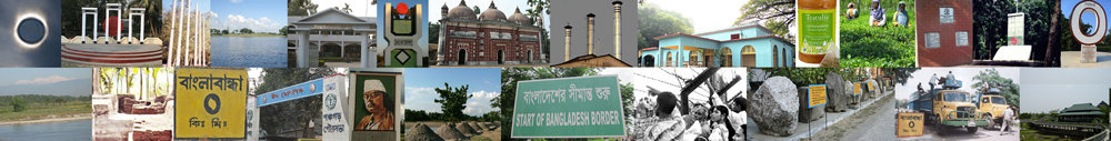
বোদা উপজেলার দর্শনীয় স্থানঃ
(ক) বোদেশ্বরী মন্দির
(খ) গোলোকধাম মন্দির
(গ) চন্দনবাড়ি মসজিদ
(ঘ) গোবিন্দ মন্দির
(ঙ) বড়শশী মাজার
(চ) মানিকপীর মাজার
(ছ) ময়দানদিঘী
(জ) নয়াদীঘি
(ঝ) কাজলদীঘি
(ঞ) রাজার দীঘি
(ট) নয়নীবুরুজ
…পঞ্চগড়ের অন্যান্য দর্শনীয় স্থানসমূহ
নদীঃ বোদা উপজেলায় ৩টি নদী রয়েছে।
(১) করতোয়া নদী
(২) টাঙ্গন নদী
(৩) পাথরাজ নদী
…পঞ্চগড় জেলার নদ-নদী
প্রখ্যাত ব্যক্তিত্বঃ বোদা উপজেলার প্রখ্যাত ব্যক্তিদের মধ্যে উল্লেখযোগ্য কয়েকজন হলেনঃ
(ক) সিরাজুল ইসলাম
(খ) কমরেড মোহাম্মদ ফরহাদ
(গ) ভাষা সৈনিক সুলতান
(ঘ) নুরুল ইসলাম সুজন
(ঙ) মোজাহার হোসেন
(চ) নুরুল ইসলাম ফারুকী
…পঞ্চগড়ের অন্যান্য প্রখ্যাত ব্যক্তিত্ব
অর্থনীতি ও শিল্প কারখানাঃ বোদা উপজেলার জনগোষ্ঠীর আয়ের প্রধান উৎস কৃষি ৭৫.১৯%, অকৃষি শ্রমিক ২.৯১%, শিল্প ০.৩২%, ব্যবসা ৯.৫%, পরিবহণ ও যোগাযোগ ৪.৬১%, চাকরি ৩.৬৩%, নির্মাণ ০.৯৩%, ধর্মীয় সেবা ০.১৬%, রেন্ট অ্যান্ড রেমিটেন্স ০.১% এবং অন্যান্য ২.৬৫%। এছাড়া বোদায় চালকল, ডালকল, বরফকল, চিড়াকল, আটাকল, হাসকিং মিল রয়েছে।
(ক) বোদার প্রধান কৃষি ফসল ধান, পাট, গম, আখ, সরিষা।
(খ) প্রধান ফল-ফলাদি আম, কাঁঠাল, লিচু, কলা, সুপারি।
(গ) প্রাকৃতিক সম্পদ নুড়ি পাথর, সিলিকা বালু।
(ঘ) প্রধান রপ্তানিদ্রব্য ধান, পাট, সুপারি, গম।
(ঙ) বোদার মৃৎশিল্প, বাঁশের কাজ ও নকশীকাঁথা উল্লেখযোগ্য কুটিরশিল্প।
…পঞ্চগড়ের শিল্প ও বাণিজ্য
হাটবাজার ও মেলাঃ বোদা হাট, সাকোয়া হাট, সারেয়া হাট, ময়দানদিঘি হাট, পাঁচপীর হাট, ঝলইশালশিড়ি হাট, তেপুকুরিয়া হাট, ফুলতলা হাট, নাসির মন্ডলের হাট অন্যতম। বোদা উপজেলার বারুণী মেলা, বোয়ালমারী মেলা ও ময়দানদিঘির মেলা উল্লেখযোগ্য।
যোগাযোগ ব্যবস্থাঃ বোদার পাকারাস্তা ৮৪.৮৬ কিমি, কাঁচারাস্তা ৫৫৮.১৬ কিমি; রেলপথ ৮.৫ কিমি; নৌপথ ১.৫ কিমি। বোদা উপজেলা সদর হতে পঞ্চগড় রেলওয়ে স্টেশনের দূরত্ব ১৮ কিমি। সড়ক পথে বোদা থেকে রাজধানী ঢাকার দূরত্ব ৩৯৫ কিমি এবং সৈয়দপুর বিমানবন্দরের দূরত্ব প্রায় ৭৩ কিমি। …Travel Tips | Accommodation | Tourist Spots
Last updated: 30 March 2024