
আটোয়ারী উপজেলা - Atwari Upazila
সুনিবিড় অরণ্য, উদ্ভিদ-প্রাণী, নদী-নালা, পুকুর-জলাশয় পূর্ণ আটোয়ারী পঞ্চগড় জেলার অন্তর্গত বাংলাদেশ-ভারত সীমান্তবর্তী একটি উপজেলা।
নামকরণঃ আটোয়ারী নামকরণ নিয়ে একটি প্রবাদ আছে “নাগর নদীর তীরে ডাকাত দলের সঙ্গে পুলিশের আটটি যুদ্ধ সংগঠিত হয়। সংগঠিত এ আটটি যুদ্ধ (Eight War বা এইট ওয়ার) শব্দাবলীর অনুসরণে আটোয়ারী নামে উদ্ভব হয়েছে।” প্রকৃতপক্ষে, এ প্রবাদের কোন ঐতিহাসিক ভিত্তি নেই।
ভৌগোলিক অবস্থানঃ আটোয়ারী উপজেলা ২৬°১১´ থেকে ২৬°২৩´ উত্তর অক্ষাংশ এবং ৮৮°১৯´থেকে ৮৮°৩৪´ পূর্ব দ্রাঘিমাংশ স্থানাঙ্কে অবস্থিত। আটোয়ারী উপজেলার উত্তরে ভারতের পশ্চিমবঙ্গ, পূর্বে বোদা ও পঞ্চগড় সদর উপজেলা, দক্ষিণে ঠাকুরগাঁও জেলার ঠাকুরগাঁও সদর ও বালিয়াডাঙ্গী উপজেলা, পশ্চিমে ভারতের পশ্চিমবঙ্গ। আটোয়ারী উপজেলার আয়তন ২০৯.৯২ বর্গ কিমি বা ৮১.০৫ বর্গমাইল। আটোয়ারী উপজেলার সাথে ভারতের সীমান্ত প্রায় ৪০ কিমি দীর্ঘ্য।
প্রশাসনিক এলাকাঃ আটোয়ারী আয়তন ও জনসংখ্যায় পঞ্চগড় জেলার দ্বিতীয় ক্ষুদ্রতম উপজেলা। আটোয়ারী ৬ টি ইউনিয়ন, ৬১ টি মহল্লা/মৌজা এবং ৬৪টি গ্রাম নিয়ে গঠিত। এছাড়া আটোয়ারীতে উপজেলা প্রশাসন ভবন, পুলিশ স্টেশন ও উপজেলা হাসপাতাল রয়েছে। আটোয়ারী উপজেলার ৬ টি ইউনিয়নের নামঃ
(১) মির্জাপুর ইউনিয়ন
(২) তোড়িয়া ইউনিয়ন
(৩) আলোয়াখোয়া ইউনিয়ন
(৪) রাধানগর ইউনিয়ন
(৫) বলরামপুর ইউনিয়ন
(৬) ধামোর ইউনিয়ন
জনসংখ্যাঃ আটোয়ারী উপজেলায় অষ্টাদশ শতাব্দীর মধ্যভাগ পর্যন্ত লোকসংখ্যার ঘনত্ব ছিল অত্যন্ত কম। ২০১১ এর আদমশুমারি তথ্য অনুসারে অটোয়ারীর জনসংখ্যা ছিল মোট ১৩২৯৪৬ জন। এই উপজেলায় বেশ কয়েকটি আদিবাসী ও ক্ষুদ্র জাতিগোষ্ঠী বসবাস করে। আটোয়ারীতে বসবাসকারী উপজাতিদের মধ্যে উল্লেখযোগ্য সাঁওতাল, ওড়াও, মুন্ডা, মাহলী, পোলিয়া, রাজবংশী, সূরা, বাউরি, হারী, তাঁতী, কীচক ও বেহারা।
উল্লেখযোগ্য শিক্ষা প্রতিষ্ঠানঃ
(ক) মির্জা গোলাম হাফিজ ডিগ্রি কলেজ (১৯৮৮)
(খ) মির্জাপুর উচ্চ বিদ্যালয় (১৮৭৬)
(গ) আলোয়াখোয়া তফসিলী উচ্চ বিদ্যালয় (১৯৩৯)
(ঘ) আটোয়ারী পাইলট বালক উচ্চ বিদ্যালয় (১৯৬৫)
(ঙ) আটোয়ারী পাইলট বালিকা উচ্চ বিদ্যালয় (১৯৭৭)
(চ) বঙ্গবন্ধু ডাংগীরহাট মহাবিদ্যালয় (১৯৯৭)
(ছ) তোড়িয়া দ্বিমুখী উচ্চ বিদ্যালয় (১৯৭৫)
(জ) সাতখামার সিনিয়র ফাজিল মাদ্রাসা (১৯৬৪)
ইতিহাসঃ ১৯০৩ সালে পশ্চিমবঙ্গের জলপাইগুড়ি জেলার অধীনে আটোয়ারী থানা গঠিত হয়। ১৯৪৭ সালে ভারত বিভক্তির সময় আটোয়ারী দিনাজপুর জেলার ঠাকুরগাঁও মহকুমার অন্তর্ভুক্ত হয়। ১৯৮০ সালে পঞ্চগড় জেলার অধীনে আটোয়ারী থানা গঠিত হয়। ১৯৮৩ সালের ৭ নভেম্বর আটোয়ারী থানাকে উপজেলায় রূপান্তর করা হয়।
আটোয়ারী থানার পূর্ববর্তী নাম ছিল ফতেহপুর থানা। অষ্টাদশ শতাব্দীর মধ্যভাগে ফতেহপুর ও গিরাগাঁও এর পশ্চিমাঞ্চলে বন-জঙ্গলে আচ্ছাদিত রাজার সড়কে ব্যবসায়ী ও সাধারণ লোকেরা চোর-ডাকাতের দ্বারা বারংবার আক্রান্ত হতে থাকে এবং কয়েকটি ডাকাত দল বনাঞ্চলে স্থায়ীভাবে আস্তানা গড়ে তোলে। ব্রিটিশ সরকারের ঊর্ধ্বতন কর্তৃপক্ষের গোচরে এ অবস্থার কথা আনা হলে দিনাজপুর জেলার জেলা ম্যাজিস্ট্রেট নাগর নদীর তীরে একটি পুলিশ ফাঁড়ি স্থাপনের সিদ্ধান্ত গ্রহণ করেন। ১৯০৩ সালে এ পুলিশ ফাঁড়িটি ফতেহপুর গ্রামে স্থাপিত হয়। ১৯০৫ সালে ব্রিটিশ সরকার এ পুলিশ ফাঁড়িটিকে আটোয়ারী থানা নামকরণ করে নাগর নদীর তীরে আটোয়ারী নামক স্থানে স্থাপন করে। আটোয়ারী থানাটি অত্র এলাকার একেবারে উত্তর-পশ্চিম কোণে অবস্থিত হওয়ায়, অন্য এলাকাগুলি যেমন-বলরামপুর, রাধানগরের দূরত্ব অনেক বেশি ছিল। ফলে আইন-শৃঙ্খলা রক্ষায় দারুন অসুবিধা দেখা দেয়। এ সমস্যার প্রেক্ষিত ১৯৩৯ সালে ব্রিটিশ সরকার আটোয়ারী থানাকে স্থানান্তরিত করে সমগ্র থানার মাঝামাঝি এলাকায় অবস্থিত বর্তমান রাধানগর ইউনিয়নের ছোটদাপ গ্রামে পূর্ববর্তী নাম অপরিবর্তিত রেখে স্থানান্তর করা হয়। কালক্রমে আটোয়ারী থানাই আটোয়ারী উপজেলা হিসেবে রূপান্তরিত হয়।
১৯৭১-এর মুক্তিযুদ্ধে আটোয়ারীঃ মুক্তিযুদ্ধ ১৯৭১ সালের এপ্রিল মাসের শেষ সপ্তাহে পাকসেনারা ফকিরগঞ্জ হাটে ১১জনকে গুলি করে হত্যা করে। ২৭ মে রাধানগর গ্রামে পাকসেনারা একই পরিবারের ৫ জনসহ মোট ৭ জনকে গুলি করে হত্যা করে। ৩ জুন পাকসেনারা সুখাতী গ্রামের ৫ জন নিরীহ লোককে হত্যা করে। পরবর্তীতে তারা ধামোর গ্রামের ১১জন গ্রামবাসিকে নয়াদিঘী পুকুরপাড়ে হত্যা করে। অক্টোবরের শেষ দিকে পাকসেনারা তোড়িয়ার ডুহাপাড়া গ্রামের ২৭ জনকে হত্যা করে। উপজেলার জয়নী বুরুজ রেলস্টেশন, পানিয়ামুখরী, মির্জাপুর, আটোয়ারী থানা ক্যাম্প প্রভৃতি স্থানে পাকসেনাদের সঙ্গে মুক্তিযোদ্ধাদের যুদ্ধ হয়। …আটোয়ারীর মুক্তিযোদ্ধাদের তালিকা | পঞ্চগড়ের শহীদ মুক্তিযোদ্ধাদের তালিকা।
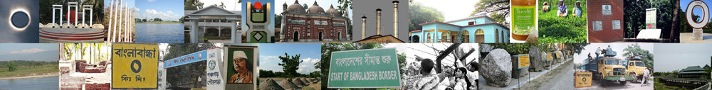
আটোয়ারীর দর্শনীয় স্থানঃ ২১০ বর্গ কিলোমিটার আয়তনের আটোয়ারী উপজেলায় রয়েছে নানা ঐতিহাসিক স্থান, মসজিদ, মন্দির ও পুকুর।
(ক) মির্জাপুর শাহী মসজিদ
(খ) ছাপড়াঝাড় মসজিদ
(গ) তিন গম্বুজ বিশিষ্ট সর্দারপাড়া মসজিদ
(ঘ) ইমাম বাড়া (মির্জাপুর)
(ঙ) বারো আউলিয়া মাজার শরীফ
(চ) বর্ষালুপাড়া জমিদার বাড়ির ধ্বংসাবশেষ (বর্তমানে নিশ্চিহ্ন)
(ছ) শোল্টহরী মসজিদ
(জ) রসেয়া ট্রেডিং এন্ড ব্যাংকিং কোং লিমিটেড
(ঝ) বলরামপুর মন্দির
(ঞ) রানীগঞ্জ মন্দির
(ট) বারহাতি বরুজ
(ঠ) কোমরখানের গড় (মাটির দুর্গ)
(ড) রানী রাসমণি কালী মন্দির (রানীগঞ্জ)
(ঢ) বলরামপুর বিষ্ণুমূর্তি (বর্তমানে প্রত্নতত্ত্ব বিভাগে রক্ষিত)
(ণ) চৌটাগী বুরুজ
(ত) টাংগন ব্যারেজ
…পঞ্চগড়ের অন্যান্য দর্শনীয় স্থানসমূহ
নদ-নদীঃ আটোয়ারী উপজেলার নামটি যেমন আলাদা, ঠিক তেমনি এখানে বহমান স্থানীয় নদীগুলোর নামেও রয়েছে ভিন্নতা। পঞ্চগড়ের নানা ইতিহাস জুড়ে আছে আটোয়ারীর নাগর, সিংগিয়া, বহু ও রসেয়া নদীর নাম। মুনোমুগ্ধকর এই নদীগুলোর দুই পাশ দিয়ে দেখা মেলে ফসলের মাঠ আর সবুজ চা বাগান। আটোয়ারী উপজেলার উল্লেখযোগ্য নদী সমূহঃ
(১) টাঙ্গন নদী
(২) পাথরাজ নদী
(৩) নাগর নদী
(৪) রসিয়া নদী
(৫) ভুল্লি নদী
(৬) তীরনই
(৭) সিংগিয়া
(৮) পেটকি নদী
(৯) বাঘমারা নদী
…পঞ্চগড় জেলার নদ-নদী
আটোয়ারীর প্রখ্যাত ব্যক্তিত্বঃ আটোয়ারীর উল্লেখযোগ্য ব্যক্তিদের মধ্যে রয়েছেনঃ
(ক) মির্জা গোলাম হাফিজ
(খ) নায়ক রহমান (আবদুর রহমান)
(গ) নাঈমুজ্জামান মুক্তা
(ঘ) তারেনী প্রসাদ রায়
(ঙ) সেমা প্রসাদ রায়
(চ) হেমায়েত আলী
(ছ) কাদের বকস্
(জ) মির্জা রুহুল আমিন
(ঝ) খান বাহাদুর আমিনুল হক
(ঞ) লায়লা সামাদ
(ট) খান সাহেব আমিরুদ্দিন সরকার
(ঠ) মীর কফিল উদ্দিন
(ড) মোহাম্মদ খাদেমুল ইসলাম
(ঢ) রানী রাজমনী
(ণ) শাহজাদ উল্লাহ সরকার
(ত) খান বাহাদুর আব্দুস সাত্তার
… পঞ্চগড়ের অন্যান্য প্রখ্যাত ব্যক্তিত্ব
স্থানীয় অর্থনীতি ও শিল্প কারখানাঃ আটোয়ারী উপজেলার স্থানীয় জনসাধারণ অধিকাংশই কৃষিনির্ভর জীবিকা নির্ধারণ করে। আটোয়ারীতে বাণিজ্যিকভাবে উৎপাদন হয় চা, বাদাম, ভুট্টা, আখ, মরিচ, পাট এবং সুপারি। সাম্প্রতিক সময়ে আটোয়ারীতে হাস্কিং মিল, মুরগী ও গরুর খামার প্রতিষ্ঠিত হয়েছে।
(ক) চা উৎপাদন আটোয়ারীর প্রধান শিল্প।
(খ) মৃৎশিল্প, সোলারশিল্প, পাটশিল্প, তাঁতশিল্প, বাঁশ ও কাঠের কাজ উল্লেখযোগ্য কুটিরশিল্প।
(গ) অটোয়ারির প্রধান কৃষিজাত পণ্য ধান, গম, আলু, চা, বাদাম, ভুট্টা, আখ, মরিচ, পাট এবং সুপারি।
(ঘ) প্রধান ফল-ফলাদি আম, কাঁঠাল, লিচু, কলা, তরমুজ।
(ঙ) প্রাকৃতিক সম্পদ নুড়িপাথর, বালু এবং কাঁচবালু।
(চ) আটোয়ারীর বিলুপ্ত বা বিলুপ্তপ্রায় ফসলাদি যব, আউশ ধান, কাউন।
(ছ) আত্রেয়ী পোল্ট্রি লিঃ (কাজী ফার্মস গ্রুপ)।
…পঞ্চগড়ের অন্যান্য শিল্প এবং বাণিজ্য
হাটবাজার ও মেলাঃ ফকিরগঞ্জ, তড়িয়া, বারঘাটি, গুঞ্জনমারী, ধামোর, ডাঙ্গীর হাট, সিকটিহাড়ী, রেলবাজার ও ধরধরার হাট এবং আলোয়াখোয়া মেলা উল্লেখযোগ্য।
যোগাযোগ ব্যবস্থাঃ অতীতে পঞ্চগড়ের পশ্চিমে ভারতের লক্ষীপুর গ্রাম হয়ে বর্ধমান পর্যন্ত এবং উত্তর-পূর্বে হলদীবাড়ী, সিলিগুড়ি ও জলপাইগুড়ি পর্যন্ত একটি সড়ক ছিল। এই কাঁচা সড়ক দিয়ে অত্র এলাকার ব্যবসায়ীগণ পশ্চিমে ইসলামপুর ও দাসপাড়া হাট এবং পূর্বে হলদীবাড়ী, মাটিগাড়া হাট, জলপাইগুড়ি ও সিলিগুড়ি পর্যন্ত ব্যবসা-বাণিজ্য করত। পঞ্চগড় হতে গোয়ালপাড়া হয়ে সোজা পশ্চিমে ভারত সীমান্তে নাগর নদী পর্যন্ত একটি রাস্তা গেছে। এক সময় এ রাস্তাটির নাম রাজার সড়ক হিসেবে পরিচিত ছিল। বর্তমান আটোয়ারী থানার উত্তর-পশ্চিমাঞ্চল ধামোর, তোড়েয়া ও মীর্জাপুর এর ব্যবসায়ীগণ রাজার সড়ক হয়ে দাসপাড়া হাট ও ইসলামপুরে ব্যবসা-বাণিজ্য করত।
অতীতে গরু-মহিষের গাড়ী ছিল এ অঞ্চলের একমাত্র বাহন, যা দ্বারা মানুষ যাতায়াত ও ব্যবসা-বাণিজ্য করত। বর্তমানে আটোয়ারীতে পাকারাস্তা ৮৩.৫১ কিমি, কাঁচারাস্তা ৬৯৩.৫১ কিমি, রেলপথ ৭ কিমি। স্থানীয়ভাবে অটোভ্যান, সাইকেল, বাস এবং মোটরসাইকেল আটোয়ারীর প্রধান যানবাহন। পঞ্চগড়ের অন্যান্য উপজেলা এবং ঠাকুরগাঁওয়ের সাথে আটোয়ারীর পাকা সড়কে যোগাযোগ রয়েছে। রেলপথে আটোয়ারীর একমাত্র স্টেশন হলো কিসমত রেল স্টেশন (শুধুমাত্র লোকাল ট্রেন-এর জন্য)। আটোয়ারীর নিকটতম রুহিয়া রেলওয়ে স্টেশন, আটোয়ারী উপজেলা সদর হতে ৮.৫ কিমি দূরত্বে অবস্থিত। আটোয়ারী-ঢাকা রুটে সরাসরি বাস চলাচল করে। আটোয়ারী থেকে রাজধানী ঢাকার দূরত্ব ৪১০ কিমি। আটোয়ারী হতে সৈয়দপুর বিমানবন্দরের দূরত্ব প্রায় ৯৫ কিমি।
আটোয়ারীর ঐতিহ্যবাহী পরিবহন পালকি বিলুপ্ত হয়েছে এবং বিলুপ্তপ্রায় গরুর ও মহিষের গাড়ি। …Travel Tips | Accommodation | Tourist Spots
তথ্যসূত্রঃ বাংলাদেশ মুক্তিযুদ্ধ জ্ঞানকোষ | মোঃ ওয়ালী উল্লাহ
Last updated: 8 March 2024